


Shipping:
Free Shipping Included
Delivery:
Estimated 2-15 Business Days
Payments:
Credit Card, Check, Cash, PayPal, Apple Pay, Venmo
Returns:
30 Days 100% Money Back Guarantee, Buyer Pays Return Shipping
Description
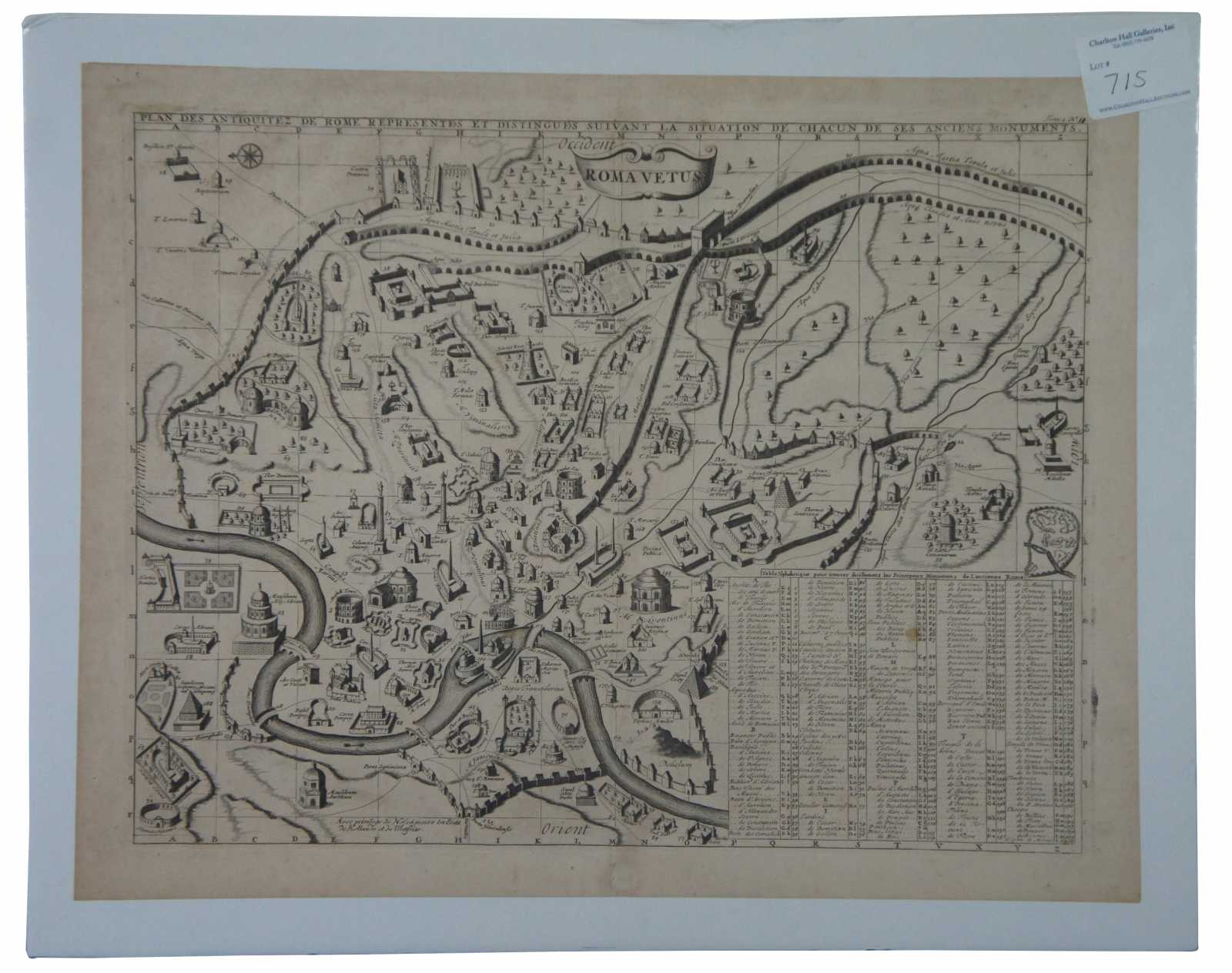
MCH2
Interesting plan of Ancient Rome. Over 100 buildings, bridges, churches, fountains, and other places of interest are illustrated and identified. A decorative gem which can be studied and enjoyed for hours. A finely engraved view from Chatelain's monumental 7 volume Atlas Historique, one of the most famous and prolific works of the early 18th Century. Henri Abraham Chatelain (1684-1743) was a Huguenot pastor of Parisian origins. Chatelain proved a successful businessman, creating lucrative networks in London, The Hague, and then Amsterdam. He is most well known for the Atlas Historique, published in seven volumes between 1705 and 1720. This encyclopedic work was devoted to the history and genealogy of the continents, discussing such topics as geography, cosmography, topography, heraldry, and ethnography. Published thanks to a partnership between Henri, his father, Zacharie, and his younger brother, also Zacharie, the text was contributed to by Nicolas Gueudeville, a French geographer. The maps were by Henri, largely after the work of Guillaume Delisle, and they offered the general reader a window into the emerging world of the eighteenth century.
Condition
Very Good - light foxing to paper; see pictures
Dimensions
19” x 15” (Width x Height)